 PAUWES Data Portal
GeoTIFF
Keywords
Contact for the resource
Provided by
Formats
Representation types
Update frequencies
status
Scale
-
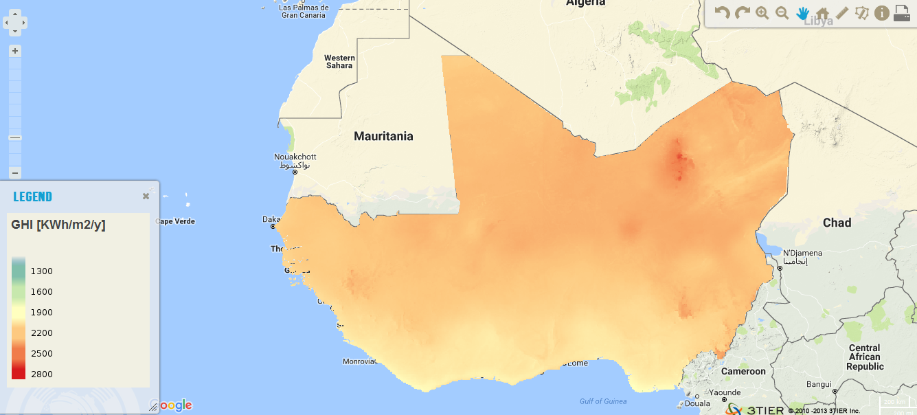
The resource was developed by CENER (The National Renewable Energy Center, Spain) for ECREEE. High resolution data of 1km x 1km developed using Numerical Weather Prediction (NWP) model from hourly meteorological weather files of over 10 years. Dataset is provided in raster format (.geotiff) at a resolution of 1 km. It ranges from 1200 to 2800 KWh/m2/year. Around 87% of the total surface of the ECOWAS region has long term annual DNI values greater than 1800 KWh/m2.
-
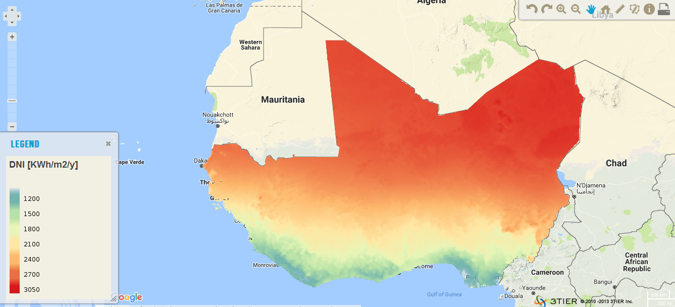
The resource was developed by NEXANT (EEUU) for ECREEE.using 3TiER global solar dataset with an annual temporal resolution. The project was funded by USAID. This parameter is of particular interest to photovoltaic installations and includes both Direct Normal Irradiance (DNI) and Diffuse Horizontal Irradiance (DIF). The format is raster (.geotiff) and the resolution is 3km.