 PAUWES Data Portal
20000000
Keywords
Contact for the resource
Provided by
Years
Formats
Representation types
Update frequencies
status
Scale
-
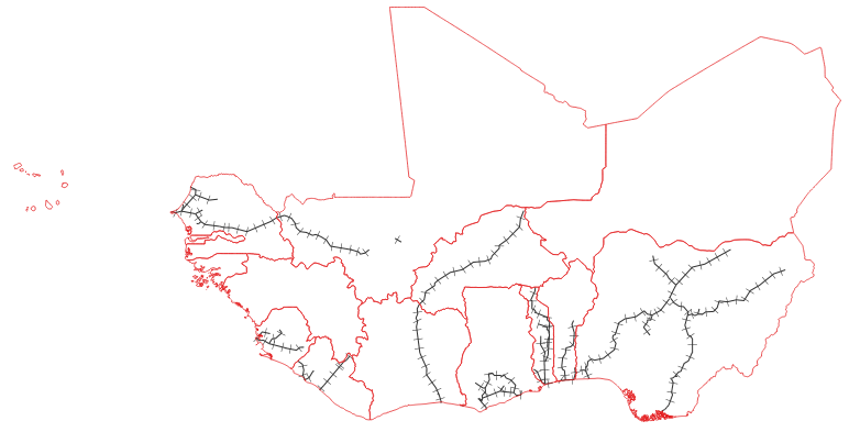
Data provides an estimated framework of the current railway network in the ECOWAS region
-

The resource was developed by NEXANT (EEUU) for ECREEE using 3TiER global dataset. The methodology is explained in the resource below available for downloading. Dataset is available in raster format (.geotiff) with a resolution of 3,5 km.
-
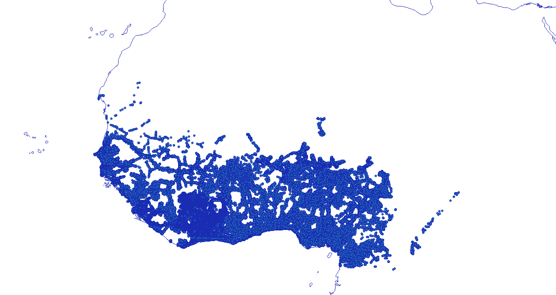
Existing and planned distribution grid network (11KV-33KV) in the ECOWAS region. The dataset is developed by the ECOWREX team by using the following sources of information: - BENIN: Ministry of Energy (2016) - BURKINA FASO: West African Power Pool (WAPP) GIS database January 2017, SONABEL - CÔTE D'IVOIRE: CI-ENERGIES - GAMBIA: WAPP database (2015) - GHANA: Energy Commission (2015) - GUINEA: Ministry of Energy, Energy Information System Unit (SIE, 2016) - MALI: EnergyInfo platform - https://energydata.info/ (World Bank, 2017) - NIGER: EnergyInfo platform - https://energydata.info/ (World Bank, dataset 2015) - NIGERIA: EnergyInfo platform - https://energydata.info/ (World Bank, dataset 2016), Nigeria Rural Electrification Program (http://rrep-nigeria.integration.org/ ), Facebook model (https://energydata.info/dataset/medium-voltage-distribution-predictive) - SENEGAL: EnergyInfo platform - https://energydata.info/ (World Bank, dataset 2007) - SIERRA LEONE: EnergyInfo platfom - https://energydata.info/ (World Bank, 2017)
-
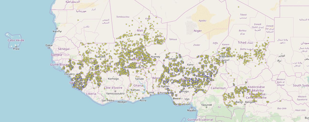
Location of education facilities that could have access to electricity through off-grid solutions by 2030 according to the least-cost analysis conducted in the framework of the off-grid solar market assessment and private sector support facility design, which was done as an activity of the sub-component 1A of the Regional Off-Grid Electrification Project (ROGEP).
-
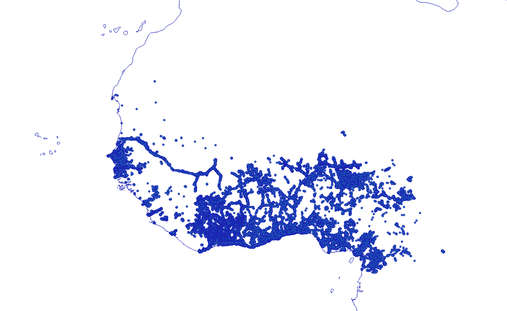
Location of settlements that could be connected to national electricity grids in 2030 according to the least-cost analysis conducted in the framework of the off-grid solar market assessment and private sector support facility design, which was done as an activity of the sub-component 1A of the Regional Off-Grid Electrification Project (ROGEP).
-
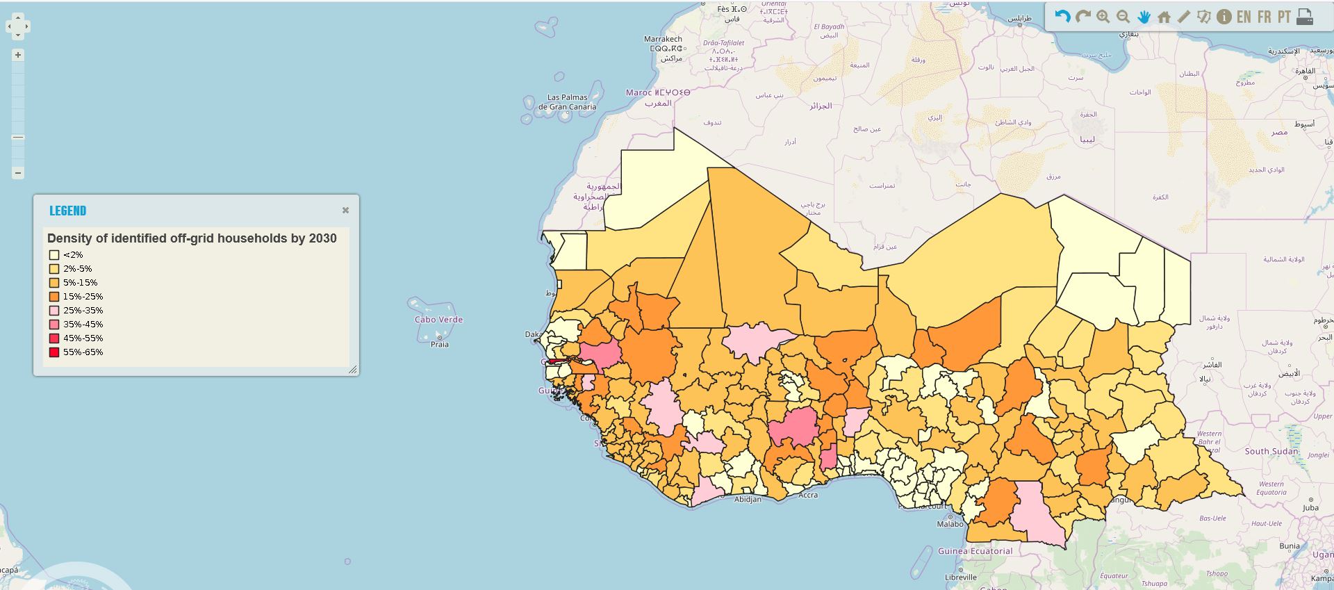
Density of identified off-grid households in ROGEP countries by 2030, per country administrative boundary level 1. The households could have access to electricity through off-grid solutions by 2030 according to the least-cost analysis conducted in the framework of the off-grid solar market assessment and private sector support facility design, which was done as an activity of the sub-component 1A of the Regional Off-Grid Electrification Project (ROGEP).
-
Location of settlements that could be connected to national electricity grids in 2023 according to the least-cost analysis conducted in the framework of the off-grid solar market assessment and private sector support facility design, which was done as an activity of the sub-component 1A of the Regional Off-Grid Electrification Project (ROGEP).
-

The data provides information about the development of the Gas Pipeline project for West Africa, including the gas station at each Member state. Data was compiled by ECREEE from the West African Gas Pipeline Company’s (WAPCO).
-
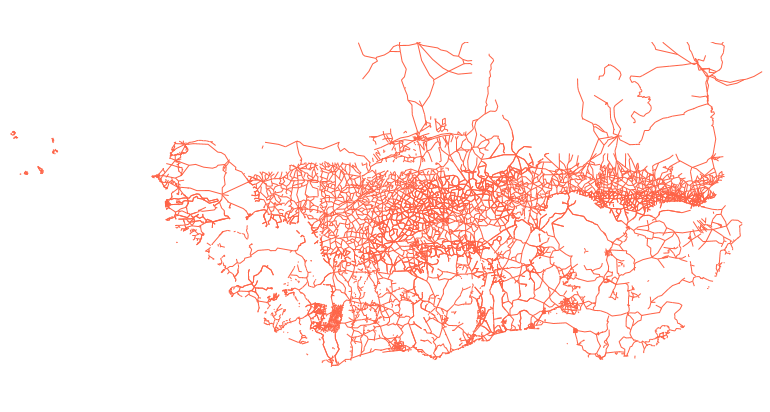
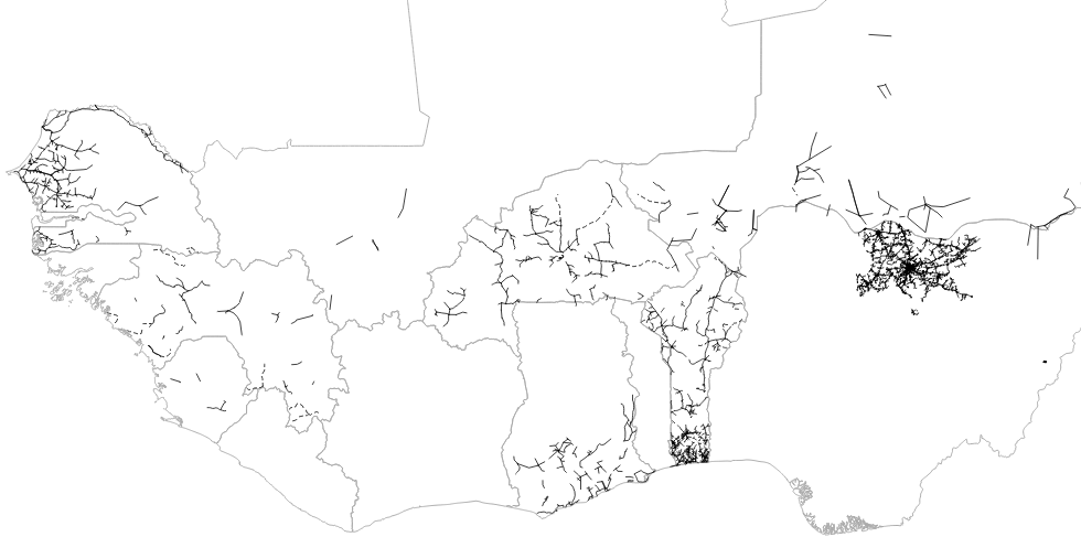
Estimated data of the entire primary and secondary road network in West Africa including the road surface type, condition and traffic volume in shapefile format. Data was compiled by TECSULT for the Infrastructure Consortium for Africa (ICA), a project which was led by the World Bank.
-
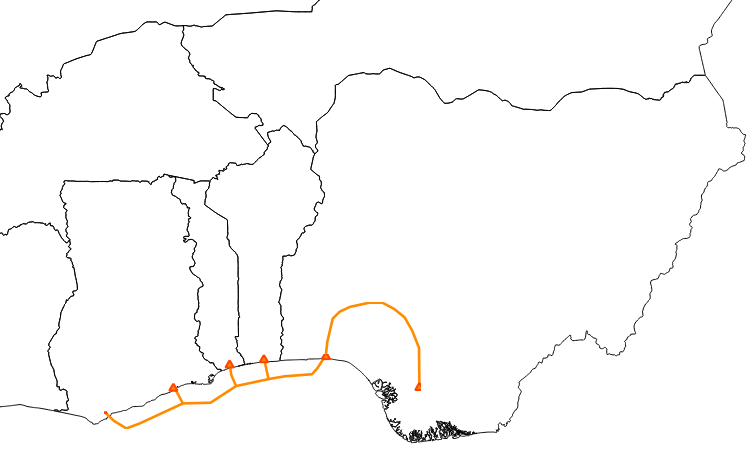
Data provides information about the development of the Gas Pipeline project for West Africa, including the gas station at each Member state. Compiled by ECREEE from the West African Gas Pipeline Company’s (WAPCO).