 PAUWES Data Portal
West Africa, ECOWAS
Keywords
Contact for the resource
Provided by
Formats
Representation types
Update frequencies
status
Scale
-

The resource was developed by NEXANT (EEUU) for ECREEE using 3TiER global dataset. The methodology is explained in the resource below available for downloading. Dataset is available in raster format (.geotiff) with a resolution of 3,5 km.
-
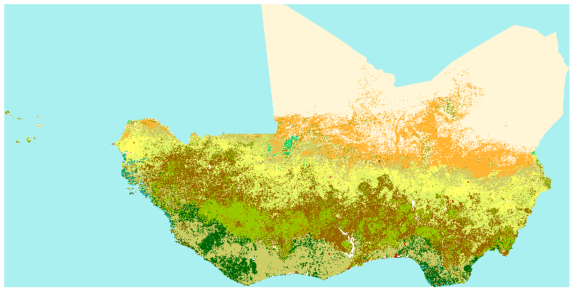
The Africa land cover map is a regional component of the GLC2000 exercise, conceived and coordinated by the European Commission’s Joint Research Centre. From the Africa land cover map, which is a regional component of the GLC2000 exercise, conceived and coordinated by the European Commission’s Joint Research Centre. The GLC2000 maps are based on daily observations made from 1st November 1999 to 31st December 2000 by the VEGETATION sensor on the SPOT 4 satellite. Legend- definition of the Gray index value: -11: post-flooding or irrigated croplands -14: rainfed croplands -20: mosaic cropland (50-70%) / Vegetation (grassland, shrubland, forest) (20-50%) -30: mosaic vegetation (grassland, shrubland, forest) (50-70%) / cropland (20-50%) -40: closed to open (>15%) broadleaved evergreen and/or semi-deciduous forest (>5m) -50: closed (>40%) broadleaved deciduous forest (>5m) -60: open (15-40%) broadleaved deciduous forest (>5m) -70: closed (>40%) needleleaved evergreen forest (5m) -90: open (15-40%) needleleaved deciduous or evergreen forest (5m) -100: closed to open (>15%) mixed broadleaved and needleleaved forest (>5m) -110: mosaic forest / shrubland (50-70%) / grassland (20-50%) -120: mosaic grassland (50-70%) / forest/shrubland (20-50%) -130: closed to open (>15%) shrubland (<5m) -140: closed to open (>15%) grassland -150: sparse (>15%) vegetation (woody vegetation, shrubs, grassland) -160: closed (>40) broadleaved forest regularly flooded- fresh water -170: closed (>40%) broadleaved semi-deciduous and/or evergreen forest regularly flooded- saline water -180: closed to open (>15%) vegetation (grassland, shrubland, woody vegetation) on regularly flooded or waterlogged soil- fresh, brackish or saline water -190: artificial surfaces and associated areas (urban areas >50%) -200: bare areas -210: water bodies -220: permanent snow and ice
-
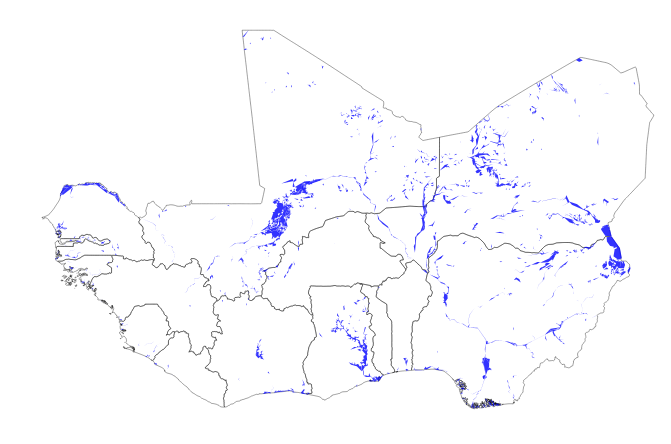
Main water areas in the ECOWAS region extracted from the DIVA-GIS project
-

Existing and planned transmission grid network (medium and high voltage lines) in the ECOWAS Region. Also covers other regions of West Africa. The Dataset comes from the West African Power Pool (WAPP) GIS database January 2017. WAPP is the source of the information. The Institution collects and validates spatial information on transmission lines in a yearly basis.